

Day Hikes in Baxter State Park, November 6-8, 2015
Day 3: Mount Coe and South Brother Loop
14km, 6:53 (4:14 moving), Gain/Loss 1150m
This was the last day of our three-day visit to Baxter. Day 1 was a short hike to South Turner. Day 2 saw us attempt to reach Baxter Peak and the Knife Edge, only to be turned back on the Cathedral trail.
We had hoped to hike up to the Owl (off Hunt Trail) on this trip, but after the previous day’s unexpected precipitation we thought the upper part would likely be ice-covered, and we didn’t want to have to retreat twice in the same weekend. After some map and guide-book examination, we settled on the Mt Coe / South Brother loop (we’re saving North Brother until we can combine it with Fort Mountain and a little bushwhacking in the spring when the days are longer).
This was going to be a very long day, with a 6+hr (that always ends up being 9+hrs) drive back to Nova Scotia, so once again we aimed for an early start. This time we arrived at the gate a few minutes before 6am, but the friendly ranger was already at her station and ready to register us. This was our third permit in three days, and she had memorized almost all of our information.
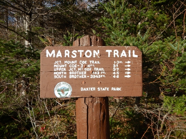
The park felt almost completely empty as we made the drive around to the Marston trailhead where we’d be beginning the hike. It was cold but the air was clear and we were headed for a trail that was almost fully below the treeline. We were hoping for a great hike, but weren’t expecting any particularly great views. Boy, were we about to be impressed!
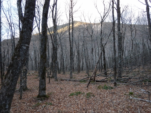
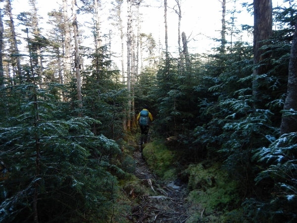
The trail starts out with a level walk through mature forest. We were just a little too late to see the fall colours.
We had read the trail description, but weren’t prepared for what we were about to find just around the corner…
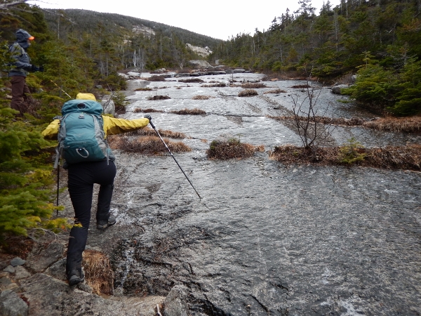
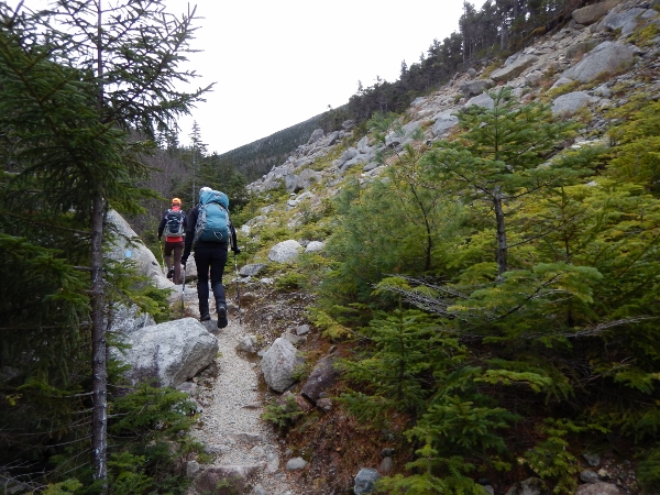
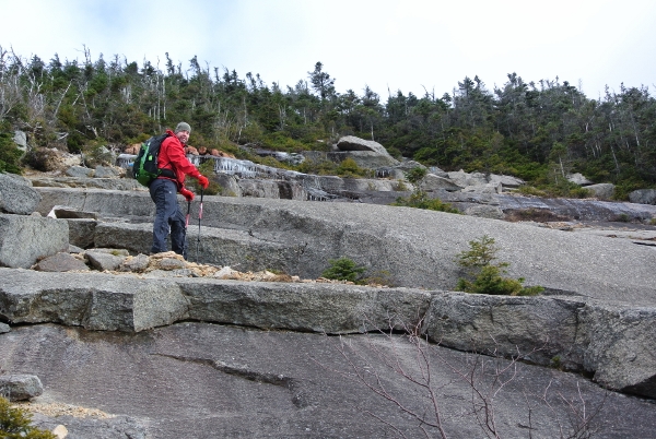
The smooth rock face was massive and continued upwards for about 200 vertical meters… and mostly covered with a thin sheet of ice. In places water was still dripping down under the ice. We weren’t sure if we were going to be able to make it to the top, but we started picking our way carefully from dry spot to dry spot.
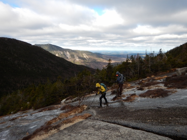
With a lot of side-to-side steps, we eventually started making progress. The views of Doubletop were becoming more and more spectacular as we gained elevation, as was the vast expanse of Maine stretched out behind us.
Every time we reached a plateau where it looked like the ice was ending, there would be another new patch up ahead. Near the top we had a few breaks, but there was one final slippery section before we entered the snow-dusted trees.
In the relative shelter, we added one more layer of clothes before venturing higher toward Mt Coe.

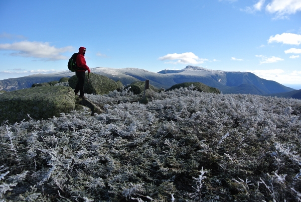
We reached the summit expecting limited views. Instead, we saw a vast expanse of Klondike basin and tablelands sloping up toward Baxter Peak. Its tip was obscured by clouds, but there was an incredible view of Pamola Peak and the chimney just beyond. It was stunning! We were amazed to see how much snow had accumulated on top, and were doubly thankful we had turned around the day before rather than push on to try to traverse that area.

We could also see South Brother and North Brother up ahead.

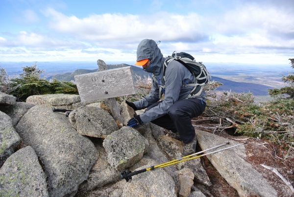
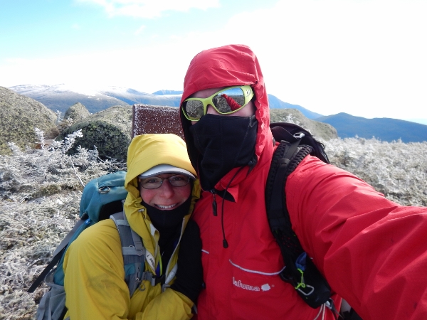
We paused for a moment while Mark propped up the Mt Coe sign, which had been knocked over.
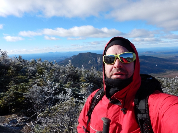
The wind was icy, so we didn’t stay long, but we couldn’t resist grabbing a few shots including this one with Doubletop in the backgound. When Wade and I crossed over Doubletop in 2013 there was zero visibility. We knew we had missed out on great views but it wasn’t until today that we fully appreciated the scope.

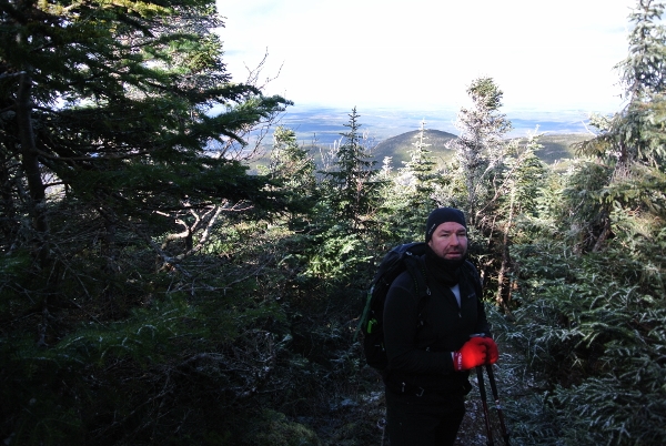
Quickly we ducked back into the woods for the trip over to South Mountain. There were a lot of layer changes on this hike!
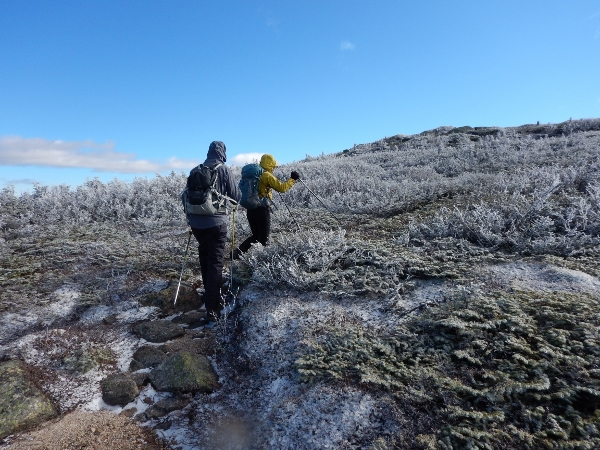
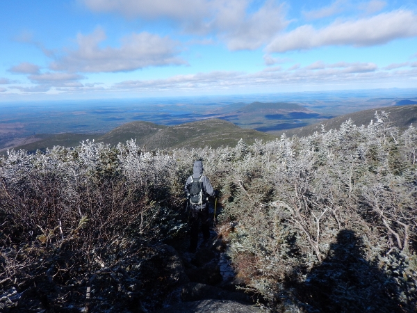
Before too long, we were poking our heads up out of the trees just below South Brother. At this point we were taking bets on whether Baxter Peak would be visible…
The last few steps… (the frosted trees made it feel like we were on another world).
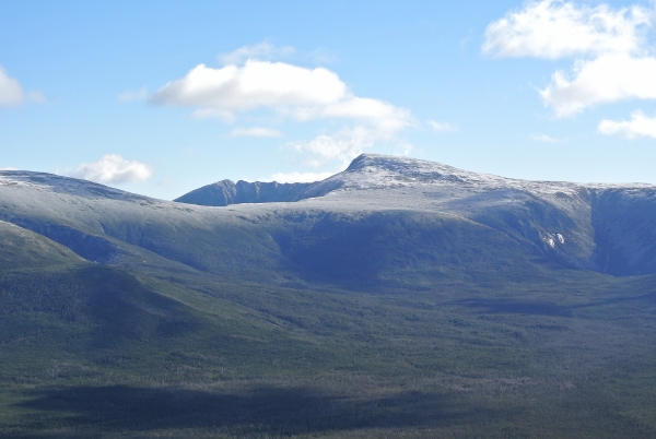
And there it was… Baxter Peak / Mt Katahdin in all its glory, with the Knife Edge stretched out behind it. Simply incredible… and totally unexpected. It was so clear we could actually see the sign on Baxter Peak. We couldn’t stop smiling. We stayed as long as we possibly could, trying to keep balance in the icy wind. The gusts must have been at least 60km/hr with wind chills well below freezing.

One last view to remember the moment before we headed down, lamenting the fact that we’d left the zoom lens at home on this day.
And then we ducked back into the woods for the last time.
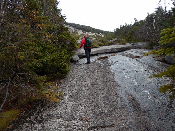
We soon warmed up as frosted trees gave way to greener forests.
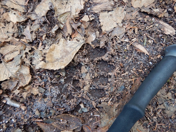
This track greeted us on the path about half way down.
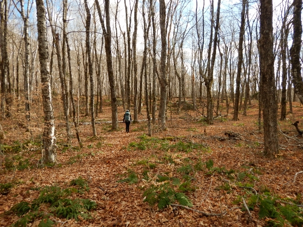
The rest of the descent down Marston trail was fairly easy underfoot as we retracted our steps for the last portion. Back on the flat we were again struck by the amazing hardwood stands. Doubletop is rising up off to the left.
And just a few minutes after this photo was taken we were back to the car and our weekend of day hikes was over. Despite having to turn around the day before, it was a fantastic trip. Given that it was November in Baxter State Park, we couldn’t have possibly asked for more. Especially today, with the incredible variety of terrain and the expansive views that far exceeded anything that we’ve seen written about these trails. If you are in the park for a few days and manage to accomplish the Knife Edge early, consider this loop for a follow-up.
We quickly uploaded some of the photos on the drive through the park so that we could show the Ranger the snow accumulation up on top.
Thanks once again Baxter… we’ll be back (of course!).
