

Planning
We came up with the idea for this route on the way home from our first trip to Baxter. We plotted out a rough outline that would give us a longer trip through the park without having to worry about weather above the treeline. We wanted to avoid a situation where lightning or other adverse conditions could prevent us from reaching our next lean-to.
We had hoped to cover the central part of the park from South Branch to Roaring Brook including the Traveler Loop. Unfortunately, a washout that summer closed part of the northern Park Tote road for a culvert replacement which meant we wouldn’t be able to hire a shuttle to transport us through the park.
Luckily we had time to modify our trip to a more east-west direction of travel which meant the shuttle would only have to travel through the southern part of the park. Our revised route meant hiking from Roaring Brook campground back to the car at Kidney Pond campground. Once we finalized the route we printed and laminated a copy of our trip plan and map for each of us to carry, for easy reference along the way. At four nights, this would be our longest backpacking trip yet.
Day 1: Roaring Brook to Russell Pond, 10.9km (3.25 hours)
We had arranged a shuttle through the Appalachian Trail Lodge. They asked us to meet them at their office in Millinocket on our way through to confirm the exact timing of our pickup at Kidney Pond. That part went off without a hitch and it was sunny when we arrived in the park, though we knew rain was in the forecast for the rest of the day. The shuttle driver was an AT hiker, and he told us lots of stories on the drive through the park to Roaring Brook. He told us that he was hoping to get to the northern part of the park and the Traveler Loop that summer because he had been told how beautiful it was, and that there is an amazing french fry place just outside the north gate.
The sun had disappeared and the skies opened up as we stepped out of the shuttle. There were lots of other hikers milling around when we signed in at the ranger’s cabin. We waited on the covered porch for the heavy showers to pass, but after about half an hour decided we would just head out anyway, since it was a short day and some variety of rain was forecasted until dark. We made it about 20 paces before a voice called out from the covered porch of a nearby cabin asking where we were headed. Turns out it was the rangers from Chimney Pond (Ranger Mark again!) and Russell Pond. Armed with knowledge of the local weather report they told us that the worst of the storm would pass in the next 20 minutes. They invited us to wait on the porch with them and we had a great chat while we watched the rain turn into a blinding downpour with huge claps of thunder and bright lightning. The intense weather blew by about 20 minutes later, right as they predicted. It was an intermittent light drizzle when we set out walking, glad that we had avoided a thorough drenching right at the beginning of our first day. The ranger headed to Russell Pond quickly left us in the dust as we ambled along and explored a few short detours along the way.
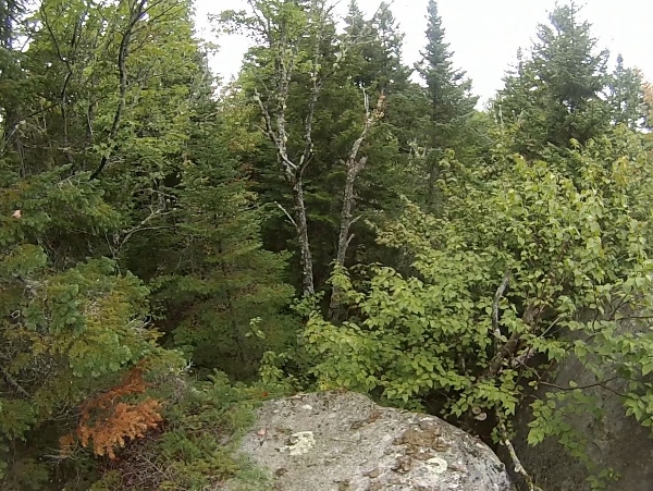
We definitely weren’t in the mountains any more, but the flatter forested areas were no less spectacular.
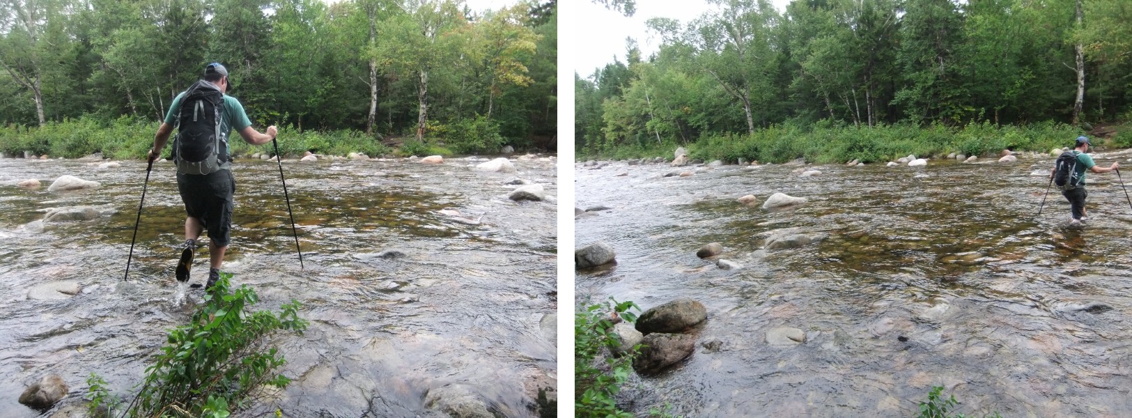
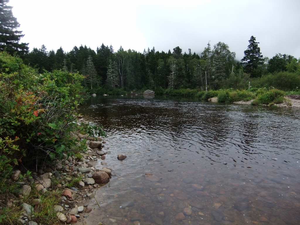
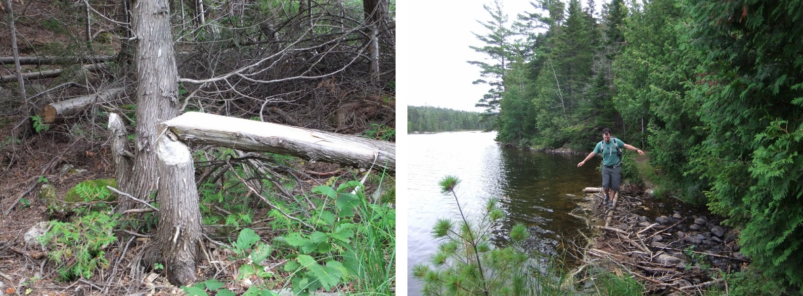
We had talked to the ranger in detail about what to expect crossing Wassataquoik Stream, but when we arrived the water seemed higher and faster than his description. Apparently he was surprised as well – he told us later that evening that he’d even paused to contemplate waiting for us, but decided we’d be OK. It just goes to show how quickly and unpredictably conditions can change. Coincidentally, just a few weeks before, we’d gathered with a group to discuss and practice various techniques for water crossings. We took some time to study the water to choose our route, then set out with loose packs, careful pole placement, and slow steps to the other side.
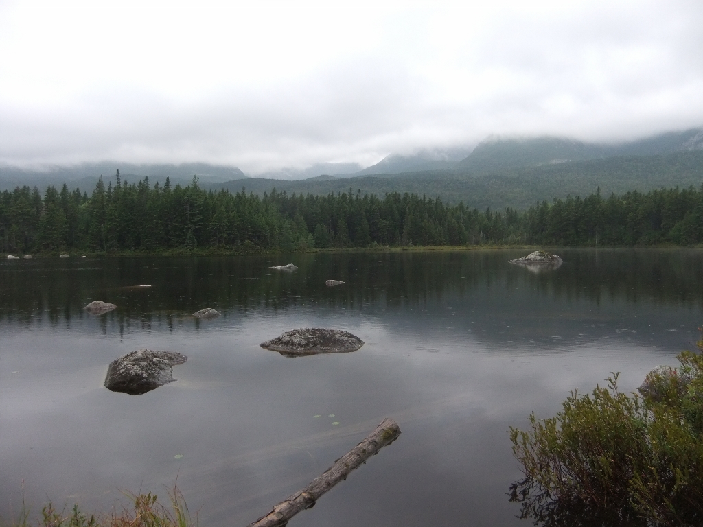
It took us a moment to figure out the campground map and orient ourselves when we arrived at Russell Pond campground, but we eventually found our lean-to, the ranger’s office and the communal bear hang. The lean-to was huge and had a view of the lake. It was damp and we didn’t bother with a fire.

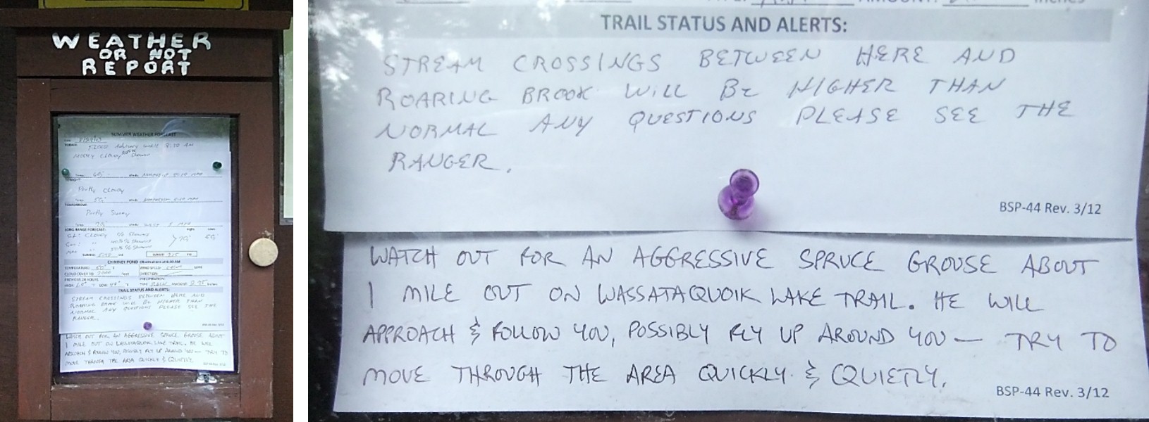
We had to chuckle at the animal warning posted with the day’s weather.
Day 2: Russell Pond to Grand Falls and on to Pogy Pond, 19.4km (8.25 hours)
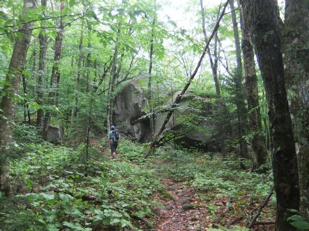
We were going to begin this day with a loop out to Grand Falls before returning to Russell Pond and heading out for Pogy Pond. It was still grey and drizzling as we set out. We passed near the Wassatoquoik Stream lean-tos, which are hidden in the trees in the photo below. This is the only place where there are two lean-tos in close proximity in the backcountry.
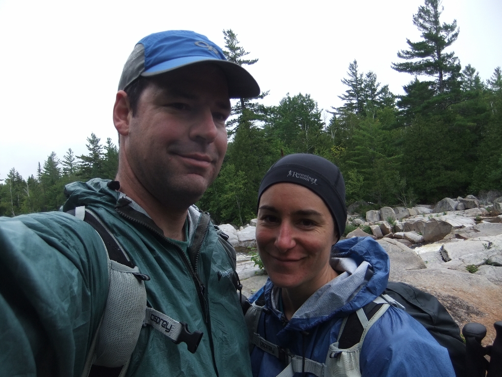
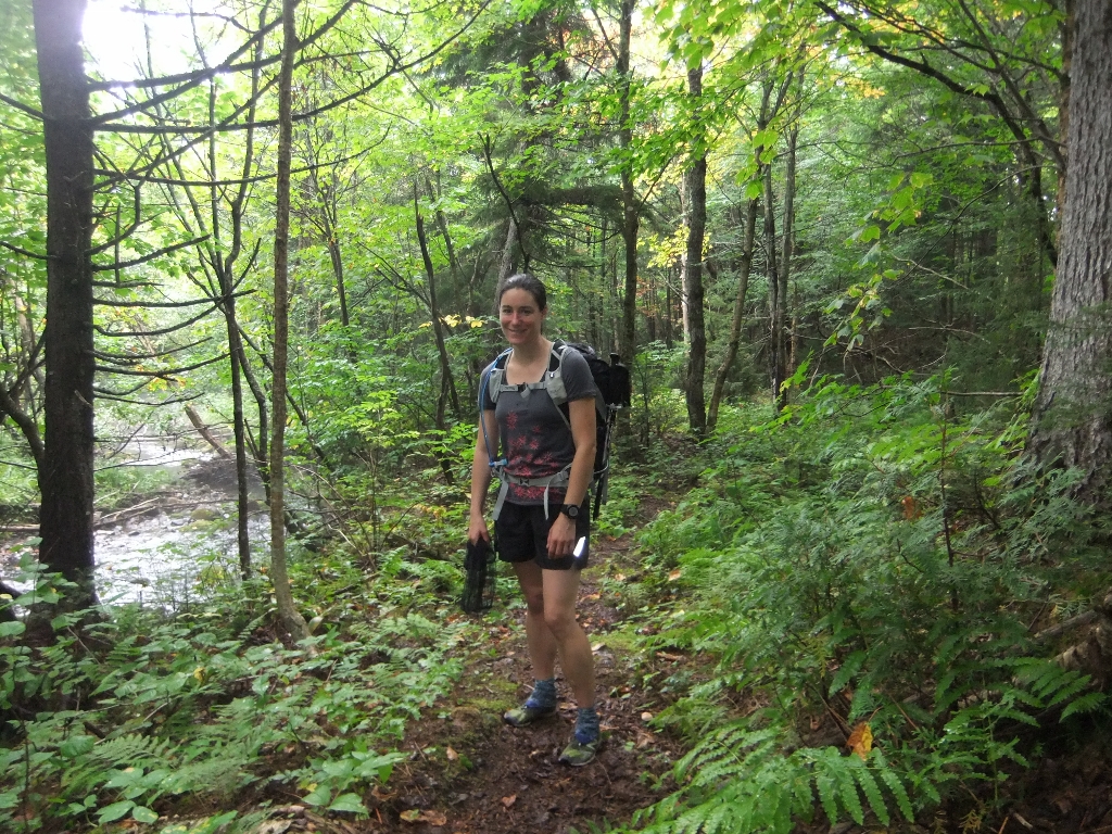
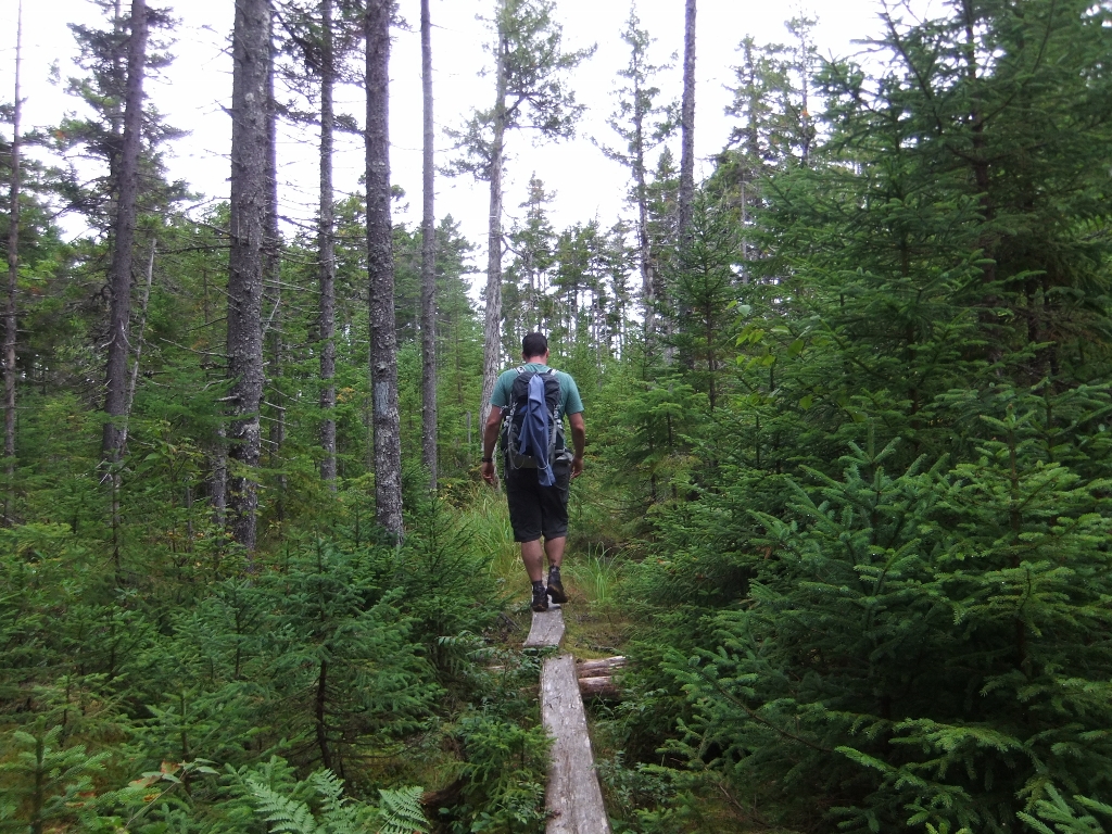
The trail began as a combination of old tote road with pieces of abandoned machinery and well-traveled footpaths. Where bushes grew over the trail they were drenched from the previous day’s rain. We rarely stop to take photos together, but I guess we weren’t feeling rushed on this day.
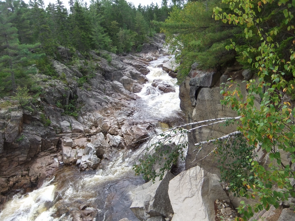
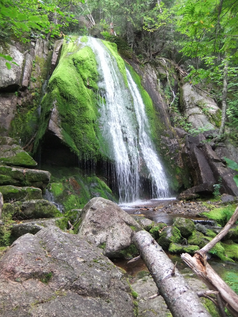
The trail narrows to follow the stream through a series of gorges and falls.
We were walking a dead-end trail toward Grand Falls and debating whether we’d continue on to bushwhack the 1.2 km to the site of the Old City Camps. We’d read about this in the guide book and it sounded interesting. The trail was becoming more overgrown with thick wet shrubs, and for a while we weren’t even sure if we were going to know where the trail ended and the bushwhack began. Once we saw the painted rock we laughed – clearly, we needn’t have been concerned.
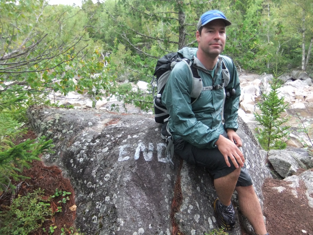
We decided to turn at the “END” given the wet slippery conditions and the fact that we still had a lot of hiking to do, but decided to take a look around for the start of the bushwhack anyway. The “END” appeared to be at the top of a steep dropoff with the falls dropping to the stream below. We were confused as to why the guidebook would suggest that it would be a good idea to venture off trail at the top of the cliff. It wasn’t until we sat down to write this post that our error became clear. The guidebook has a ton of useful information but some times making sense of that information is very difficult. Upon rereading this section we see that the bushwhack is NOT actually from the end of the trail, but from where the trail leaves the old tote road a little way back.
On the way back to Russell Pond we decided to hike up the Caverly Lookout Trail. It took some willpower to add in the extra climb up the spur, but the guidebook promised fine views. Well, this is another reason to chat with the ranger first. Some of the information in the guidebook is dated… by as much as a couple of decades or so. Although the trail offered some nice views along the way, the view from the top was simply of new growth forest. Blueberries at the top made it well worth the effort.
We arrived back at Russell Pond as the day was clearing and views were appearing out of the mist. We had a great chat with the ranger and learned a lot about the detailed records that they keep and the typical places people choose to visit. It can’t be said enough, if you have a chance to chat with the backcountry rangers, do it! Based on his records, less than 200 people had hiked to Grand Falls the previous year and he guessed that no more than ten percent of those people completed the loop. The majority just hike out and back from Russell Pond. That explains the overgrown portions.
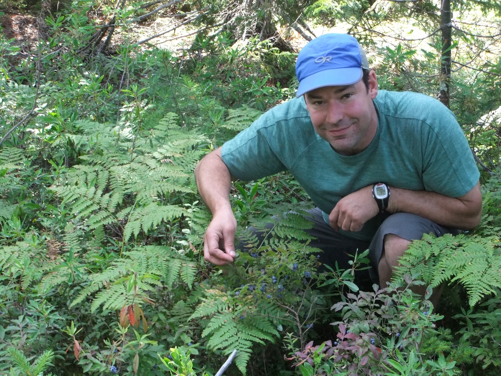
We’d seen the odd berry along the way, but parts of the trail between Russell Pond and Pogy Pond were covered with blueberries! Fresh berries are one of the best morale boosters, even early in a trip when you are carrying good food to begin with. We ate our fill and even picked a few to bring with us for a snack later on.
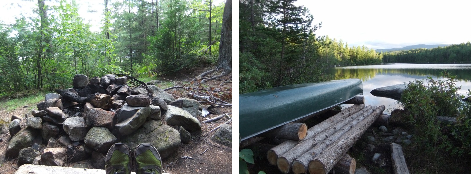
Blueberries were definitely the most memorable part of the walk to Pogy Pond, but we do remember that the final approach to the lean-to was a bit deceptive. You briefly see the pond but then lose sight of it as you are walking along its west edge, so that we wondered a few times whether we had missed the turnoff to the lean-to. Again, we needn’t have worried – the trail was well-marked. Once we arrived… what a place! The lean-to itself was one of the smaller older style ones. It had a great fire ring built just outside and some drying wood stashed underneath. The outhouse was definitely well-ventilated.

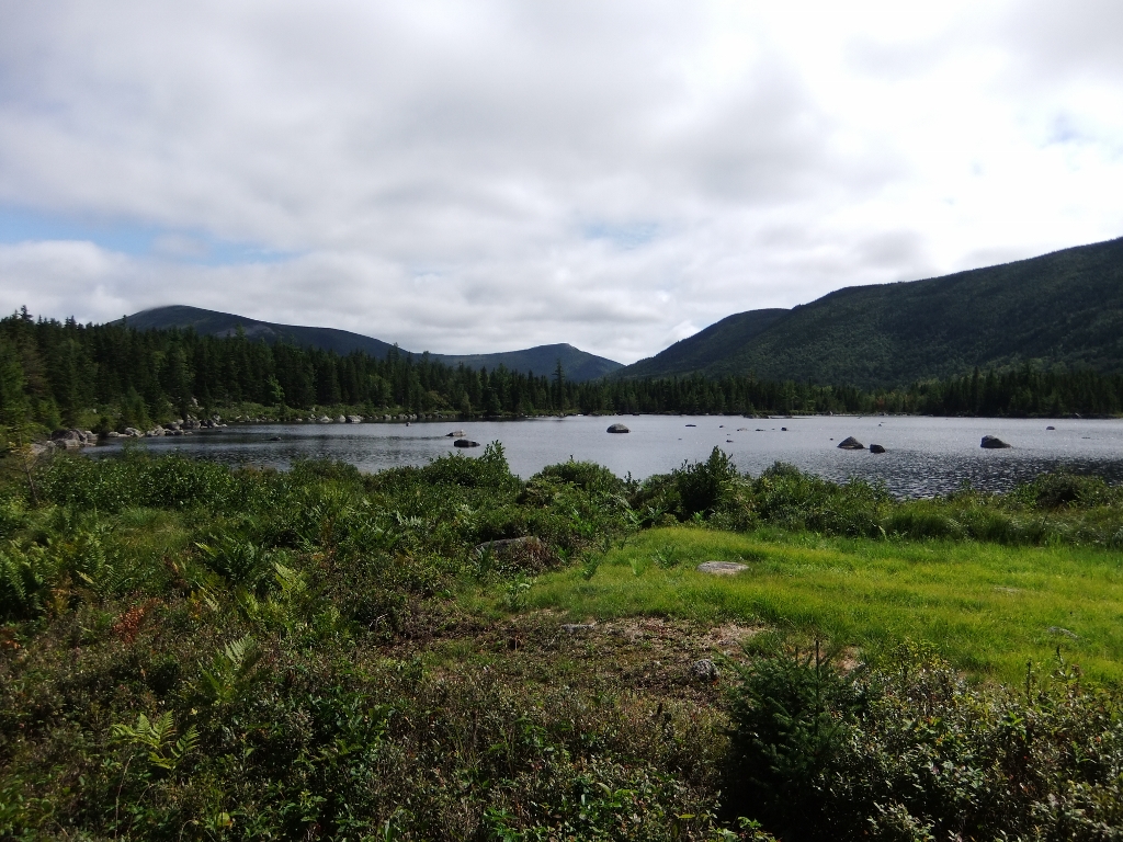
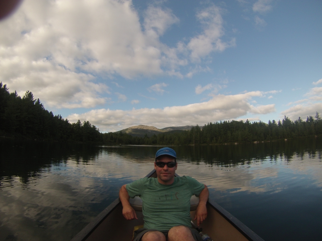
We knew there was a canoe at Pogy Pond, but we were blown away the postcard view at the lake’s edge. We grabbed paddles and lifejackets from the storage locker on the outside of the lean-to and jumped in. (Canoes are available for rent at $1/hr, to be paid to a ranger before you leave the park.)
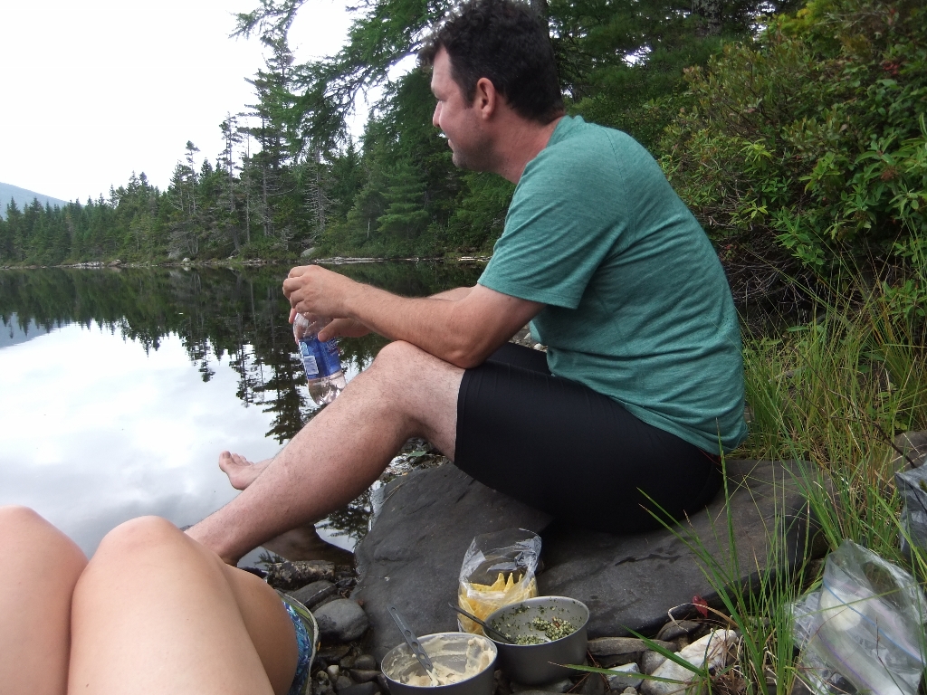
This was only day two, but still floating around in that water sipping red wine (just sips… we had one bottle’s worth, 2 people, 5 days…) and looking up at the mountains in the distance felt absolutely decadent. Pogy Pond is not that big and I think we paddled around the whole area before heading back to the lean-to in time to make supper and a small fire. We crawled into our sleeping bags and watched the fire burn down. The perfect end to an amazing day!
Day 3: Pogy Pond to Little Wassataquoik Lean-to, 15km (9.5 hours)
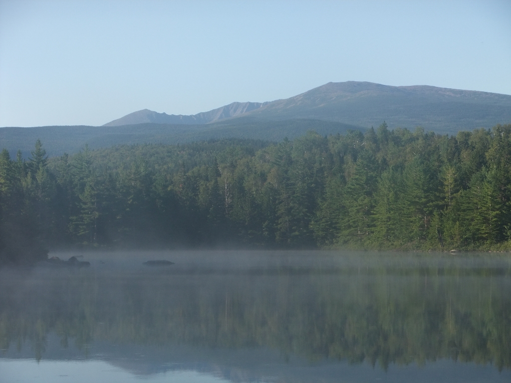
When we awoke in the morning we just had to walk back down to the lake for one last look. At first we were simply enjoying watching the steam rise off the water when we realized we could see the Knife Edge off to our left! We didn’t pick it out through the cloud cover the day before. Just a little parting gift from Pogy Pond.
Because of the washout and the Park Tote road closure, our revised route meant that we’d be backtracking today toward Russell Pond to pick up the Wassataquoik Lake trail. This meant more blueberries! but an otherwise slow start to the day. We’d seen no one since leaving Russell Pond, but near the blueberries we ran into a family headed to Pogy Pond. There were two school-aged children carrying their own packs and they all seemed to be having a great time, which was nice to see.
There are beavers throughout the park, and intermittently we came across dams in various stages of repair. This one actually made the walking easier.
We stopped for a hot lunch at the site where the canoe is located for the Wassatoquoik Lake Island lean-to. The lean-to is alone on the island, and sounds like a dream destination. It was unfortunately fully booked during our trip dates, but it’s definitely on the list for another time.
After lunch we passed Greene Falls. The moss-covered falls were pretty spectacular. It was damp and humid in this area, almost like a micro-climate. All the green, though beautiful, was exceptionally slippery.
We were heading to the Little Wassataquoik lean-to. We had assumed that it would be on the lake and were hoping it would have a nice swimming spot. In fact, it didn’t even have a lake view. It was buried deep in damp woods, but wasn’t without its own special charms. Earlier in the day we’d met a hiker and chatted for a few minutes on the side of the trail before parting ways. He was hiking solo and birding. Turns out he stayed at Little Wassataquoik the previous night. He spoke about the lean-to with a grin. We didn’t think too much about it as we parted ways. As soon as we sat down in the lean-to the grin made perfect sense when we saw wood shavings lying below a freshly installed electrical outlet.

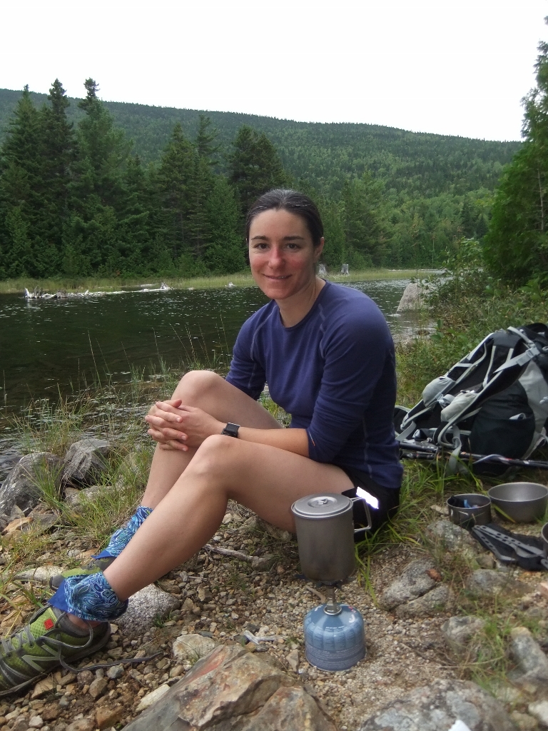
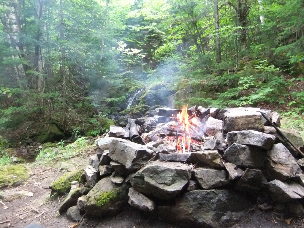
In front of the lean-to was another great firepit, and sitting in the lean-to you could look out past the crackling fire to a babbling brook with a small waterfall about 50 feet away. Sounds of the water helped lull us to sleep. Of note, in the dark it was a bit of a challenging hike to the outhouse which was located 200ft back toward the main trail. The small river crossing required you to be at least partially awake. The firewood supply was also severely depleted in the immediate vicinity and required some hiking to find anything small enough to break by hand. We decided that a saw would be helpful for breaking up the larger pieces of downed wood on future trips.
Shortly after arriving we set out to set up our bear hang (it’s never fun to wait until dark). We had to venture a fair distance from the lean-to to find a suitable spot. It was a pitch dark night when we returned to hang our food later that evening, and it took us a while to find the spot again. Lesson learned – even though our line was fluorescent yellow, we’ll consider attaching some more strongly reflective material for situations like this in the future.
Last summer this lean-to was removed and replaced with a tent site. The park posted an interesting story about the process.
Day 4: Little Wassataquoik Lean-to to Nesowadnehunk Campground, 16.9km (7 hours)
In the morning we took a short detour up the Wassataquoik Lookoff trail. The views were great, but it was too hazy for photos. Most of this day was flat and the trail was soft under foot. We had bug head nets along for this trip, and we quickly realized they would be most useful for keeping spider webs out of our mouths in the forested sections. Highly recommended!
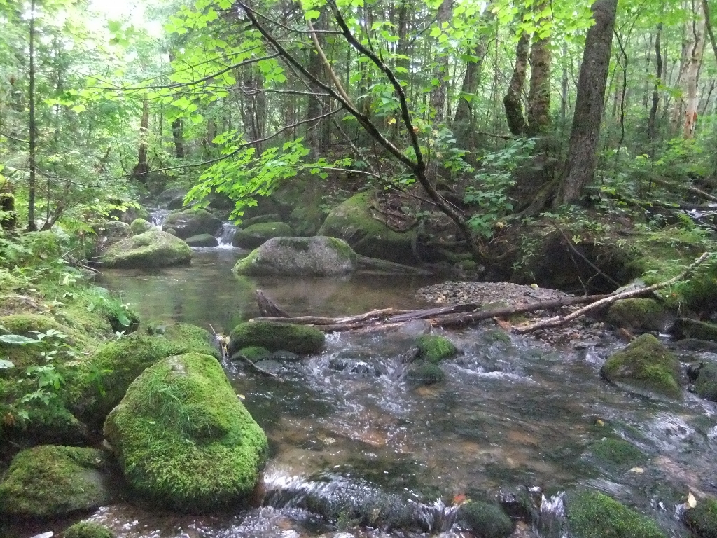
The trail intermittently followed winding streams.
There were some huge trees in the area, including this one that had fallen partially blocking the trail.

There were some flies in this area, and we had been thinking that if there was no one at the new Center Pond lean-to we would take out the canoe and eat lunch drifting in the pond. We’d read the park’s story about building the lean-to and were curious to see it for ourselves. As we approached we saw hanging gear, so we quietly retreated to find a spot along the edge of the lake. It was here that we ran into a couple who told us they were on an End-to-End traverse of the park from the South Gate to the North Gate. Now that is an adventure! We chatted for a bit and then they walked on past us to the lean-to while we stopped to eat. On their way back they reported that it wasn’t actually other people at the lean-to, but lifejackets stuffed under the eaves that we had seen. Oh well, it was a nice lunch anyway. Dehydrated hummus, tabouli and corn chips for starters!
We often wondered how the couple fared, usually while dreaming about our own gate-to-gate walk. We intermittently searched for some record of their journey, but only recently learned that it was Carey Kish (Maineiac Outdoors) and his wife Fran. Although Carey told us he hasn’t written (yet!) about that specific experience, he did share a link to an article about backpacking in the park.
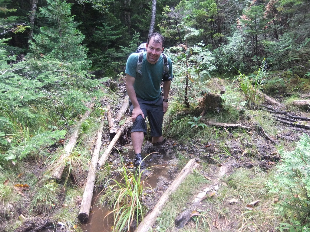
After lunch and a dip in the pond we got back on the trail. It was flat with plenty of mud. The raised logs kept you out of much of the mud, unless you stepped on one of the many unpredictable slippery patches…
What to say about our time in Nesowadnehunk campground? Despite all of our detailed trip planning we had failed to consider the implications of staying in a drive-in campground on night 4 of a 5-day backpacking trip (don’t do it!). The first hint of a problem came when we almost weren’t allowed to check in because we had left the park permit in the car (make sure you keep your permit with you at all times). After convincing the ranger we were supposed to be there, we realized the second flaw in our plan… firewood, which we would now have to carry all the way from the central woodshed to the most remote lean-to. As we were making slow progress through the campground with our wood, we realized the even bigger mistake. The site next to us was occupied by a group of young hikers who had just returned from a drive to Millinocket and were unloading beer and a bottle of Grey Goose, along with their fresh steaks on the BBQ. Until that moment we’d been looking forward to our supper of dehydrated chicken, macaroni and vegetables. We thought about using our last $5 to ask them for a beer, but then decided we didn’t want to worry about carrying out the glass bottle. The final issue was the bear hang… or lack of one. The car-camping sites are full of warnings to keep your food secure, but bear hangs are not provided for campers travelling on foot, and there are almost no suitable trees. We spent a lot of time looking around and ended up sharing the one viable option with another group who happened to be backpacking as well. Both for safety and environmental reasons, it’s surprising that the park hasn’t chosen to install something permanent.
We spent a lot of time soaking our tired feet in the river, and made it an early night. We’d decided a 5am start made sense so that we could finish the trip in time for lunch in Millinocket and a relaxing afternoon before driving home the next morning.
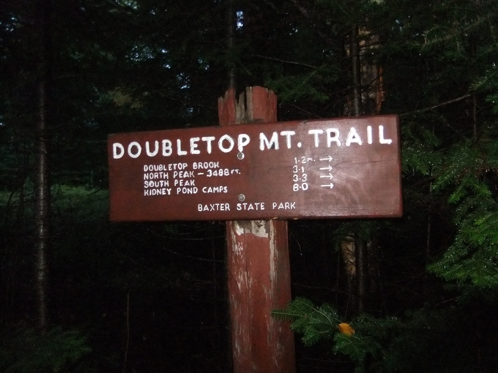
Day 5: Nesowadnehunk Campground over Doubletop Mountain to Kidney Pond Campground, 13.5km (6 hours)
It was pitch dark when we headed out toward the Doubletop mountain trail. It was slightly confusing figuring out how to leave the campground, but once we found the trailhead it was easy going. 13km and counting…
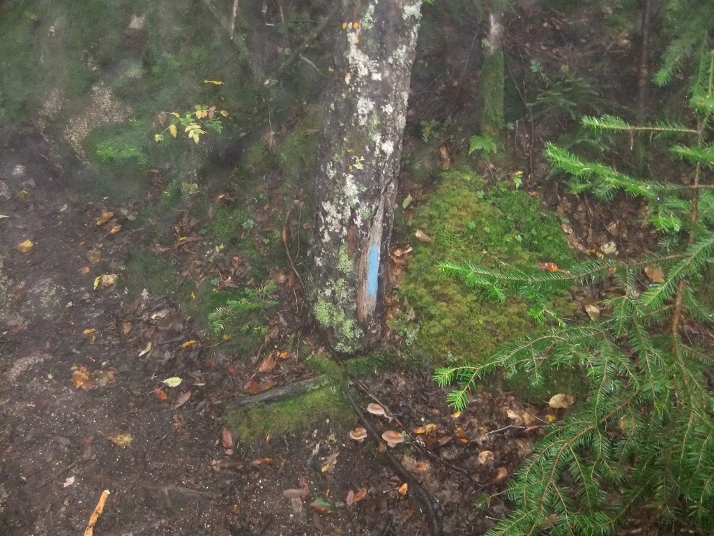
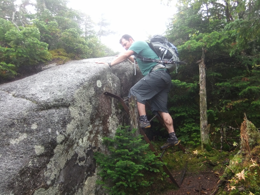
Doubletop starts steep and stays steep. In places the blazes were painted on trees only a few inches above the ground, which ends up being at eye level while climbing. We were both pretty tired and it was very slow going. We were watching the altimeter on my wristwatch and stopping at regular intervals. That little mental game was the only thing that kept us going in a few places. Though it was now daylight, the fog was getting thicker as we climbed.
Finally, we are almost at the top. I think we passed some great viewpoints on the way up, but all we saw was white haze.
Well we made it to the top… so said the sign and the marker…
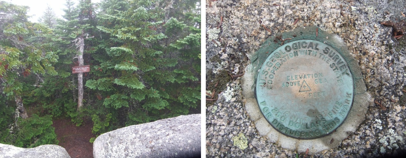
The air was wet with mist and there was little else to see. We were disappointed because we had heard about the spectacular views. But we opted to push on rather than to wait to see if the conditions improved. The trees quickly faded into nothing as we traversed the area between the two peaks.

Heading down was slippery and slow-going in places with many steep areas with bare rock and little to hold on to. There was a fair amount of slipping and sliding (including on your butt) in between climbing over large rocks, scrambling, and patches of easy walking.
As we got lower, the trail levelled out to mud, mud, and more mud. After days of seeing hardly anyone on the trail we started seeing group after group after group. This was the long weekend before school started, and we couldn’t even count the number of “new” school sneakers we saw along the way. At this point the day was rapidly clearing and the temperature was rising. We joked about running back up to check out the view.
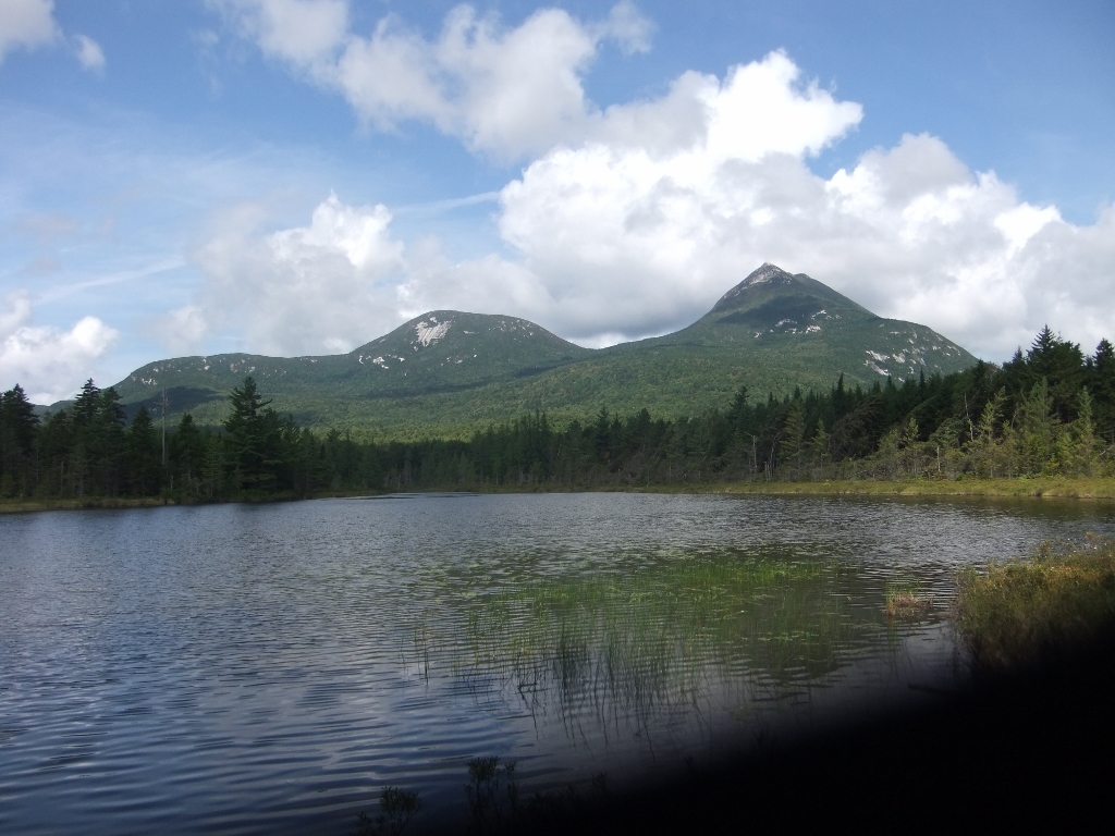
The last hour or so was a bit frustrating because there were quite a few crisscrossing trails. Despite our maps were weren’t always sure precisely where we were, and even the signs didn’t always clarify the situation. We made it back to Kidney Pond without any real trouble though, just in time for unobstructed views of the peaks in near-perfect conditions. Sigh…. Doubletop goes back on our list for the next trip.
Highs / Lows
This was by far our longest trip to date, and we were pleased with the way our gear and food worked out. Thinking about a gate to gate traverse has also provided hours of entertainment. The low was definitely our night at Nesowadnehunk campground. It was also disappointing to miss the views on Doubletop, though the wind and mist made for a pretty neat experience.
