

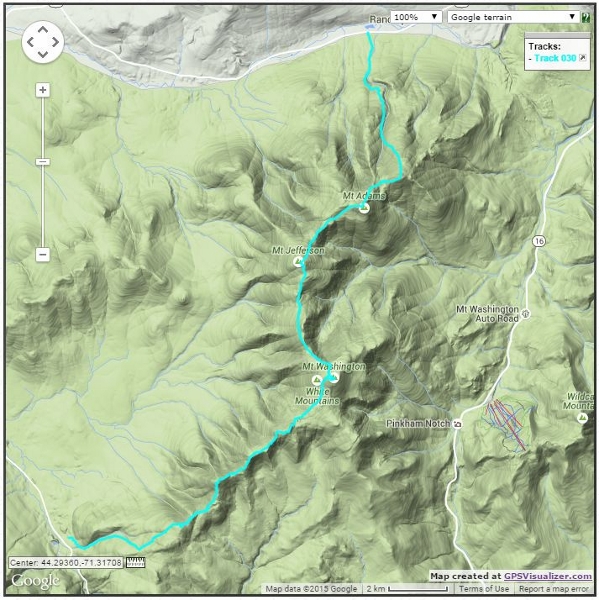
Presidential Traverse
June 23-24 with an overnight at Lakes of the Clouds Hut
We were both looking forward to this one. The Presidential Traverse is one of the best known destinations in the White Mountains, and it had been on our list for some time. This trek gets its name because it spans multiple 4000+ foot mountains which are named for former US Presidents.
We decided to hike between the Valley Way/Appalachia Trailhead and Crawford Notch (Highland Center) and split the hike into two days with an overnight at Lakes of the Clouds Hut. We normally backpack, but the tent site locations just didn’t match our route this time. This would be a new experience for us, but smaller lighter packs were definitely a plus!
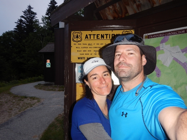
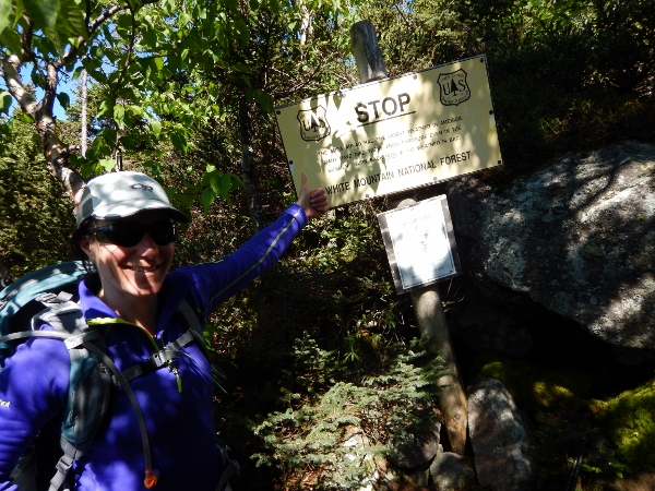
We put a lot of thought into which direction to make the trek (easy day first or second, big descent on more or less tired legs, travelling with or against the AT hikers), but in the end it was the weather that decided for us. A forecast of heavy rain, severe thunderstorms and possible hail on Day 1 meant that we would need to avoid above-treeline travel. We stopped by the AMC’s Highland Centre to fine-tune the route. We were lucky to talk with an experienced hiker who agreed with what we were thinking – we would head from south to north with an early morning start that should place us safely inside Lakes of the Clouds Hut before the thunderstorms. Notch Taxi Service provided the final logistical part of the plan. We dropped off our car at the Appalachia Trailhead and got a drive back to spend the night in a cozy cottage at Carroll Motel and Cottages. Thanks to another cheerful on-time pickup from Notch Taxi we were at the Crawford Notch Trailhead more or less awake and ready to hike at 5am.
Day 1: Crawford Notch Parking Area to Lakes of the Clouds Hut
13.2km, 5:55 (moving 4:24), Gain 1577m, Loss 630m
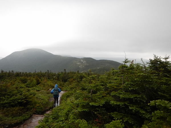
It was overcast but not raining as we set out up the Crawford Path. The trail is not particularly technical or hard underfoot, though it feels rather relentless because it has long straight uphill runs. The rain started in earnest about the time that we reached what were probably some great views of the Presidential Range ahead. We put on our rain jackets and headed off with determination to beat the worst of the storm.
With such determination, in fact, that we forgot to make the short detour over to Mt. Pierce. Oh well, back we went…. a total of 2.5 km and 45 minutes of hiking for what should have been a 300m round trip. Not a great start to the day…

The rain was driving at times as we retraced our steps, but luckily it was intermittent.
The rain slacked off but the wind picked up as we approached Mt Eisenhower. A few times we worried the wind might rip right through our raingear, but it held up to the challenge. Thank you once again Frogg Toggs!
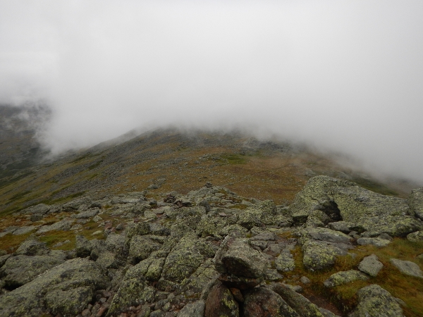
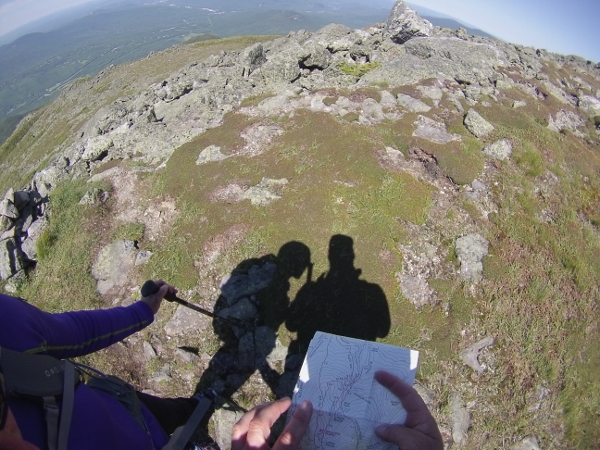
After Mt Eisenhower the thick fog persisted, and we had to check the map a few times to confirm our route over Mt Monroe.

We even pulled out the compass for one quick orientation check to make sure we were headed in the right direction down to the Lakes of the Clouds Hut. This is definitely not the place to come unprepared! Soon enough it appeared out of the fog just in front of us.
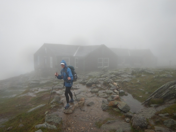
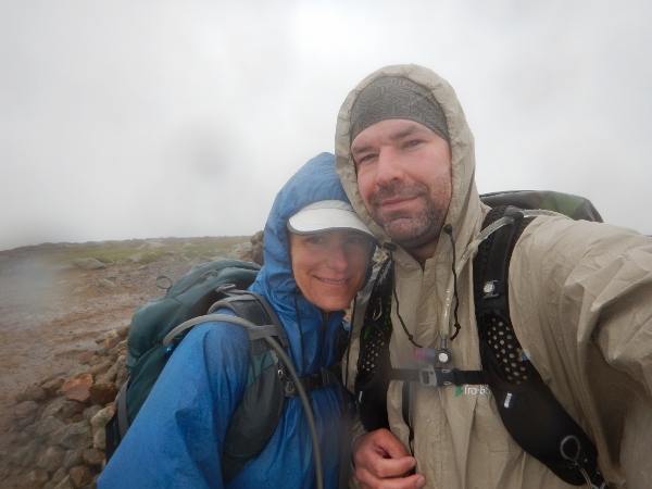
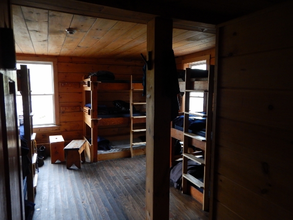
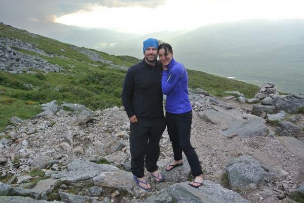
Success! We arrived at the hut before lunch and without hearing a single rumble of thunder in the distance. There were only few people around when we arrived, mostly guests from the previous night who decided to wait out the bad weather. Despite the large windows in the seating area, the hut seemed dark and rather dreary when we first arrived. We took off our outer layers right by the front door to try to minimize extra water in the hut and went to check out our room. We had been told that the bunks were first-come-first-served, but we had been assigned a bunk room when we arrived. They told us that it was a 12-bunk room but that there would only be 6 in the room, though that all changed as other groups arrived and the weather continued to play havoc with people’s plans.
We were dried off and ready to relax by noon. We were grateful for hot soup and grabbed a spot in the front corner of the dining area so that we would have views of any storms that rolled through. The thunderstorms never materialized, though we were still plenty happy to be inside. We grabbed some books from the library and after reading for a while decided to check out the hut’s game supply. We were very surprised to see Puerto Rico sitting on a nearby table.
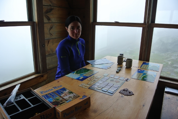
We’d played the game before and we knew that it required more than 2 players, so we decided that we would play 2 players each, with the highest cumulative score winning. Anyone who knows the game will appreciate that it was quite the brain exercise, but still a nice way to pass the early part of the afternoon sitting in dry clothes, sipping on hot tea, and watching more and more wet hikers arrive.
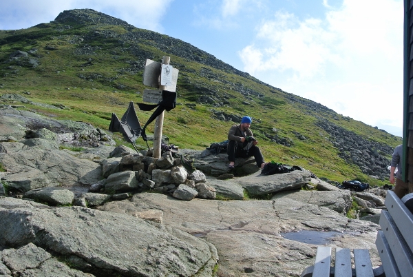
Later that afternoon the skies cleared, much to the disappointment of all who were hoping to see a dramatic thunderstorm, but much to the delight of everyone feeling cooped up inside. We headed outside to explore the area around the hut in the wind.

It stayed windy and as soon as a few rays of sunshine poked through the clouds there was a minor stampede as people remembered all their wet gear dripping inside – within moments the building and surrounding rocks were covered with clothing, boots and packs of all shapes and sizes.
People were making jokes and laughing and the whole place was suddenly much more animated. There was just enough sun and wind to actually make some good progress on the drying when it was time to gather for supper. We brought everything back inside and grabbed a spot at one of the tables.
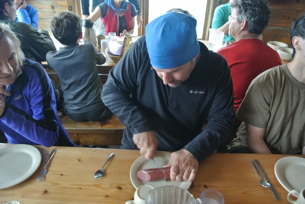
Supper is served “family style” at the AMC huts which means hikers share the portions delivered to each table. The meals are 4 course and the servings are generous – this day it was a 21-bean soup and homemade bread followed by vegetarian lasagna and peas, then chocolate cake and coffee. Wade can choose to elaborate on the vegetarian lasagna if he wishes, but suffice it to say there were some envious looks as he sliced into a big piece of sausage that he brought along for just this occasion (yes, he shared!).
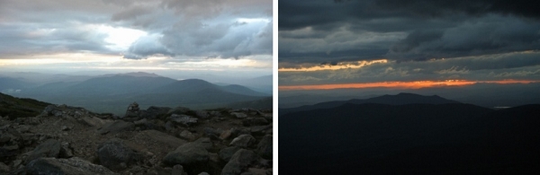
As if the meal wasn’t already a bit of a production, it was interrupted with cries of, “it’s raining” as people rushed outside to gather their last few “drying” items. After supper the rain continued to come and go, and some brave people ventured out for a walk, though the winds remained fierce. It was an amazing experience to feel the wind, watch the water being whipped up into the air, and see the clouds flying by. The sunset was also incredible, and it more than made up for the missing thunderstorm.
We were thankful that we had basically the whole day to rest our legs… it wasn’t so rough to get up to the hut, but we had a big day coming up and we were planning on another early start. The forecast was for a clear sunny day but we wanted to get an early start because there was a lot of trail left between us and the car. We were in bed early, with our alarm set for 4am.
Day 2: Lakes of the Clouds Hut to Appalachia Parking Lot
18.0km, 5:45 (moving 3:29), Gain 1138m, Loss 2279m
Luckily our bunk-room mates were gracious. Especially after we got up at 4am only to climb back in our bunks a few minutes later. Wade looked out the window and couldn’t even see the ground. Seemed like waiting for some light would be the smarter option. The through hikers (they had also been storm-stayed and were scattered around the hut floor) were just waking up as we were the first to hit the trail at 6:20 to begin the climb up to Mt Washington.
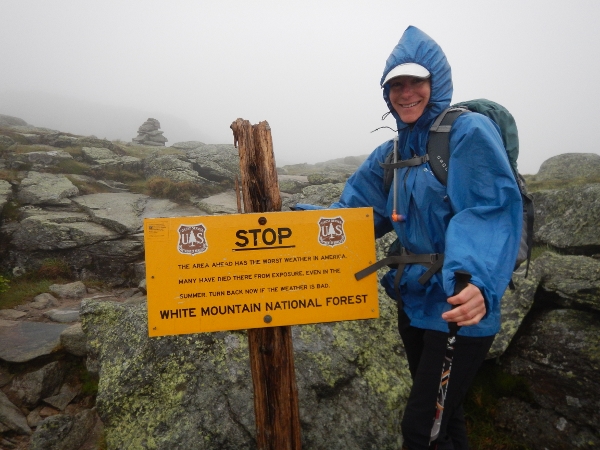
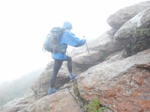
The wind was fierce as we gained elevation and we were solidly in the clouds, though the trail markings and cairns were sufficient to keep us easily on track.
It was like another planet as we approached Mt Washington. It was difficult to balance in the gusts and I was thankful for trekking poles. We could tell that the sky was imminently clearing as there were moments of clearing with tiny patches of bright blue appearing out of the grey sky. Mt Washington’s huge towers were only visible from a few feet away and without the cairns I would have thought that we had wandered into some out-of-bounds secure area.

The trail brought us out right near two AMC employees who were unloading lumber from the back of a car. It was just about 7:30 and I’m not surprised they seemed a little shocked to see us. After a few more steps they faded back into the fog and we were alone again.

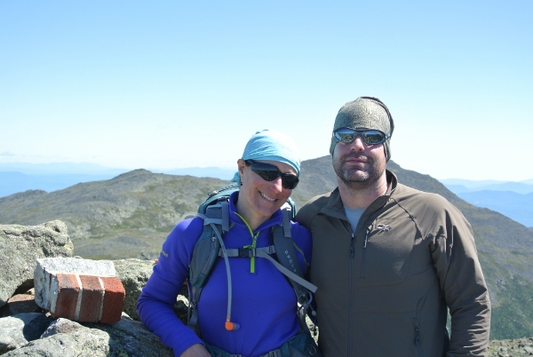
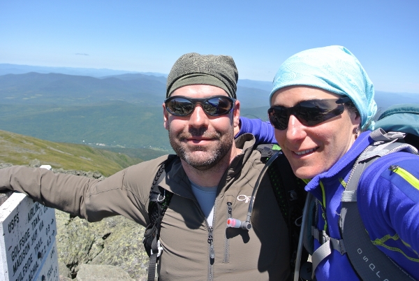
We didn’t see or hear anyone else at the Summit. It was still other-worldly with intermittent moments of clearing. We saw the summit but the gusts were simply too strong to walk the few feet up for photos. We took refuge behind the visitor’s centre to watch the sky and wait for a break in the wind.
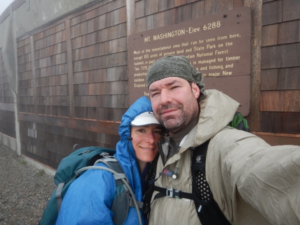
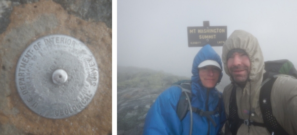
Heather pulled out her phone to check the Mount Washington Observatory and we were not surprised to see that the windchill was 22F (-5C)! (The next day we looked back at the detailed forecast and saw that peak gusts at the time were 130km/hr). After about 20 minutes there were more signs of clearing and we were able to sneak up to the summit for a quick photo between gusts. We’ll go back some other time for the views and the chili-cheese dogs, but we wouldn’t trade this experience for anything!
Within a few feet of the summit we joined the Trinity Heights connector and could feel the wind decreasing and the temperature rising with almost every step. Soon we reached the railroad tracks and crossed over. I suggested that Wade step back up for a photo. Just as he did I thought I heard a noise in the distance and he felt the track start to vibrate under his feet! He jumped down as the train appeared out of the fog in front of us…

Believe it or not we had even talked about this possibility, but thought that the first train of the morning wasn’t until later on. Luckily it’s pretty slow moving – it is after all the world’s first mountain climbing train. After it passed we continued our descent and slowly removed layers as the weather improved.
We passed one couple who appeared to be trail running up toward the summit and a father and his teenage son who appeared much less prepared for the adverse conditions that lay ahead. Luckily for them the weather was improving and the summit facilities would have been open by the time they arrived.
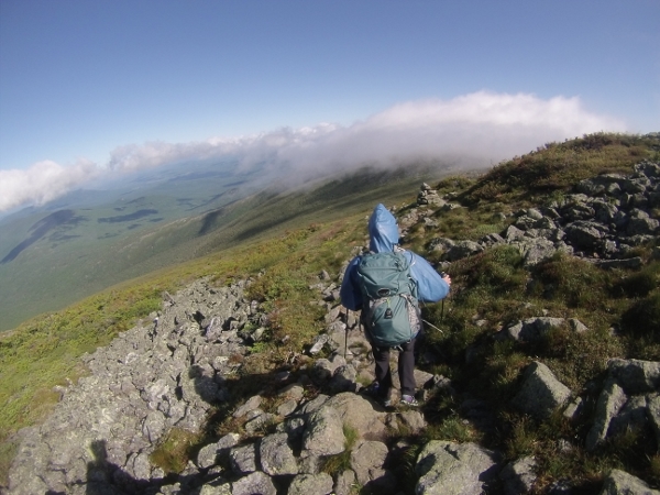
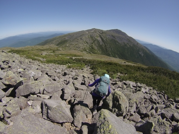
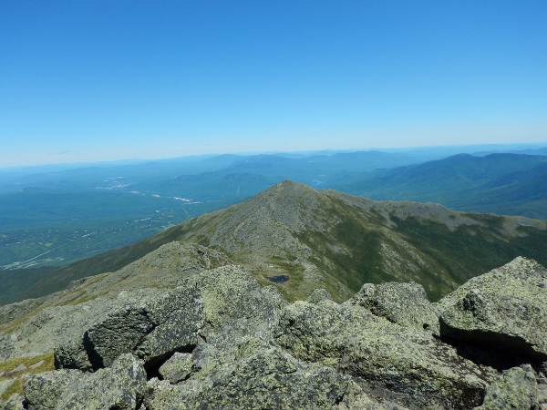
Within an hour of leaving Mt Washington it was clear and we had expansive views ahead and back toward the summit for most of the rest of the day. It is definitely an impressive sight!


We didn’t see anyone else until we arrived at Mt Jefferson just as another father and son were arriving from the opposite direction. It was convenient to have a “non-selfie” picture for once. They were headed to the Madison Hut after starting their day at a nearby trailhead. We would play leap-frog with them for much of the day.
From Mt Jefferson it was a nice hike over to Adams. We passed quite a few groups and chatted with a wide variety of day hikers and backpackers. It was neat to see all the variety of trips bringing people to the same place. It was a warm sunny day at this point, though we passed at least one patch of snow holding on in the sun.

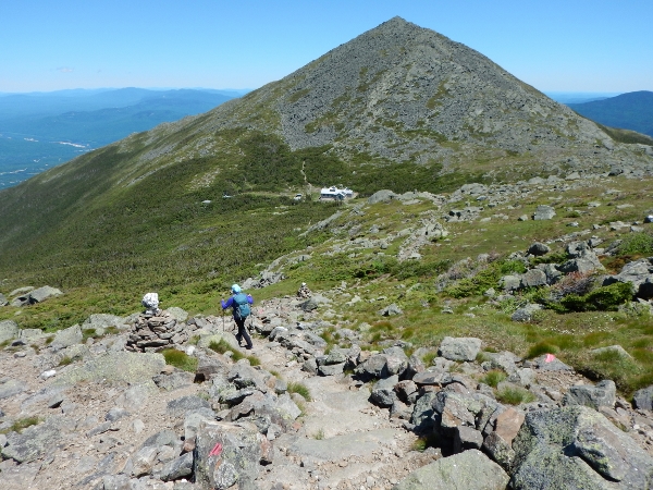
Mt Adams proved to be the biggest challenge of the day, scrambling up and then back down in strong winds. The picture doesn’t remotely do justice to the balancing act it took to stay still for the shot.
We were getting tired at this point and it was a slog on down to the Madison Hut where we were planning to have lunch and take a break before heading up Mt Madison then back down to the car.
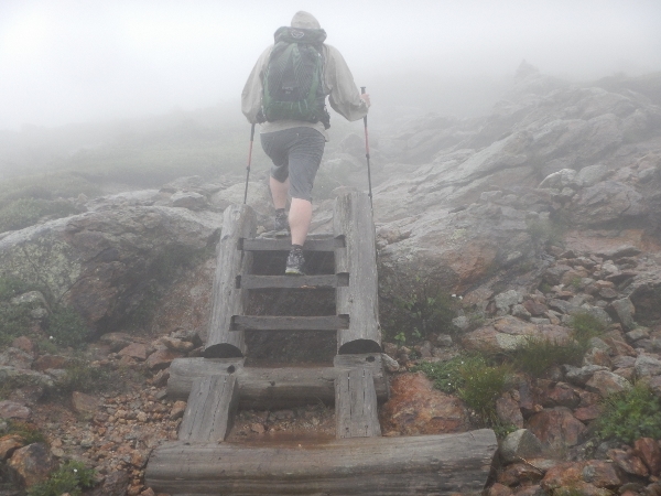
Just before Madison we passed an AMC working group restoring the trail and stairs which lead down to the hut.
Madison Spring Hut is beautiful and, despite the fact that there were lots of people coming and going, the tables were empty. If you are looking for an incredible bunk-room experience, this is definitely the place!

We left our gear and shoes outside (yay for camp shoes!) to give our feet a break and enjoyed bowls of hot soup to supplement our packed lunch (we always bring enough to be self-sufficient in case the scheduled stops don’t work out as planned). It was a late lunch and we were both stuffed when we headed out again. After a long chat with one of the hut staff we decided to stick with our original plan which was to take Watson Path down from the summit. We were cautioned that the trail wasn’t very well marked or maintained, but that seemed like a challenge and was far more appealing than backtracking to one of the easier trails. The trail up to Madison could almost be called crowded, but once at the top we were alone as the last group of hikers disappeared along a different trail.
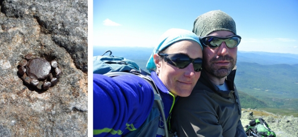
We sat down long enough to appreciate the accomplishment – Mt Madison was official White Mountain 4000′ number #17 for us, and we were pretty pleased with our first trip to the area (we had backpacked the Pemi loop the week before).
It was easy enough to follow Watson path above the treeline, though it never hurts to keep an eye on the map.
The trail does have some rough patches further down into the wooded areas. We were watching the clock and picked up the pace as the trail levelled out once we reached Air Line.
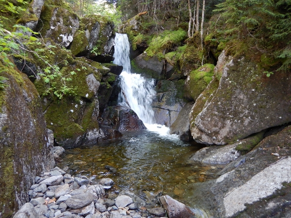
There are also a lot of small water crossings and even a few waterfalls on the way out.
With a few minutes of gentle running we reached the parking lot and waiting car at exactly 6:00pm.
GPX Track
High/Low
This was an epic trip! The only low was walking right past Mt Pierce on the first day. The high had to be experiencing the wind and fog/clouds on Mt Washington.
