

February 16, 2015
This may become an ongoing series if I become overly ambitious, as with life.
Wade’s Day Dreaming Phase
The scenario runs almost identical every time and it reads like this… It’s 3am, I’m awake, I’m bored, I’m not going to do anything productive so I might as well plan a trip. Other than boredom the significant motivating factor for this trip was some shiny new winter gear that I haven’t had the opportunity to use on a winter backpacking trip yet.

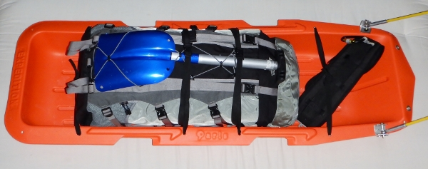
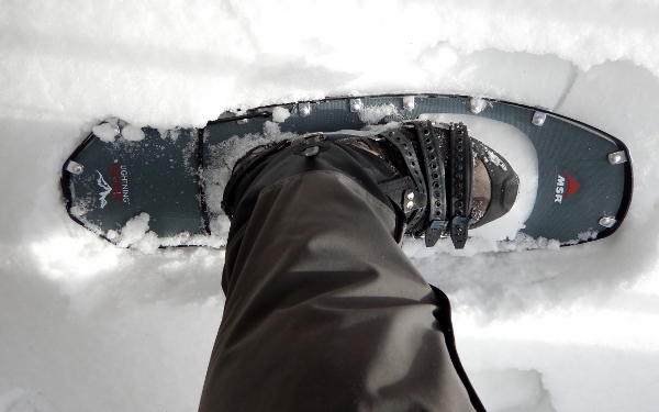
When I get super ambitious I might write a post about each of these items. In the meantime a picture is all you’re going to get.
Usually I start my planning with a list of “wants” and then I’ll try to come up with a plan. This time it was shiny new gear; next time it might be a herd of pack goats and a squirt bottle. For a destination trip, the location is the “want”. For local trips, the location is chosen to match the “wants”.
Finding a Location
Now that I’d chosen my “wants” for this trip I had to figure out how I could find snowy winter conditions without driving too far (about an hour for me). This is a very tricky prospect when you live in Nova Scotia. We commonly see 20°C temperature swings and up to 20cm of snow and 20mm of rain in a 24h period. You can’t guarantee winter but if you plan a little you can increase your odds immensely. One of the best chances of snow close to Halifax is the centre portions of the province during February. The weekend of February 27th is the only one that works so that’s when we’re going.
Since there are no official winter backpacking routes in NS I’d be planning something in a protected wilderness area. The vast majority of Nova Scotia is privately owned and these protected areas afford amazing opportunities that aren’t available in Nova Scotia’s provincial parks, where winter camping and backcountry camping are almost entirely prohibited. Neither Cape Chignecto Provincial Park (mainland NS’s only provincial wilderness campsites) nor Kejimkujik National Park permit camping from November to May. Nova Scotia currently has 44 protected wilderness areas, and Gully Lake Wilderness Area seemed to be the best option for a number of reasons but this quote sealed the deal, “Winter snow cover in this region is among the best in mainland Nova Scotia, allowing for excellent winter recreation.”
I decided to get a group together for this trip and wanted to try to gather a few new faces so posted the event with Halifax Adventure Seekers. We’ve been paying attention more and more to the impact we leave in the wild, and the wilderness areas are a good place to practice the principles of Leave No Trace since you have zero man-made facilities to lean on.
Criteria
Since we were touring in a wilderness area without established sites I limited the group to 8 participants with no more than 4 two-person tents. Finding tent sites in NS forests is almost always quite challenging due to historical forestry practices, the lack of topsoil exposing roots and rocks, and dense underbrush, to name just a few. The plan is for pairs of snowshoers to share one tent and one sled containing two backpacks. This way teams can take turn pulling the sled, and all of the gear can be easily carried on the fly if any sections of the terrain prevent easy sled pulling.
Plan B: Too much rain to pull a sled and not enough rain to row it…. regular ol’ backpacking it is!
The Nuts and Bolts
This will be fairly standard planning for us. We are unfamiliar with the area, but that’s often the case with our Nova Scotia wilderness trips. I start by reading any trail or area descriptions that I can find. Then I get a map of the boundary lines for the wilderness area, which is often far more complicated than it should be. This area also has an existing trail network. I’ll try to find out as much as I can about the area from trail descriptions and online maps. The next step is to print the free Nova Scotia 1:10,000 Topographic Maps and plot out the trail information. Then I compare the maps and satellite imagery trying to identify the most likely campsite possibilities and estimate daily lengths. And then… I just make us a set of maps. This time I’ll be drawing right on the topographic map; other times we are able to enter waypoints and then print maps from the Canadian topographic series using Garmin BaseCamp software.
Beyond that I have no idea what the area will provide for camping… we’ll see at bedtime.
Planning Resources
Topographic Maps:
Nova Scotia 1:10,000 Topographic Maps
Trail Maps & Guides:
Nova Scotia Shared Use Trails
Municipality of Colchester Gully Lake – Nuttby Hiking Trail System
We’re planning to head out February 27th. When the fingers thaw, we’ll post a trip report.

Hey, do you still winter camp in NS?
LikeLike
Glad you found the site. We still head out year-round, with some winter trips in NS. Feel free to send us an email at misadventuresinthewild@gmail.com if you’d like to chat more.
LikeLike