
Pemi Loop (Pemigewasset Wilderness Area)
Backpacking, 3 nights June 16-19, 2015
This would be our first time in the White Mountain National Forest, and our first New England hiking outside of Baxter State Park. Wade had discovered the Pemi Loop while scouring maps, and it seemed like a good introductory trip. We had purchased the Appalachian Mountain Club‘s maps and guide book and read reports from lots of other hikers including the detailed resources compiled by Philip Werner (Section Hiker).
Wade had initially planned a longer trip including North Twin, Zealand and Owl’s Head, but we altered the route to be able to attend a family gathering, so decided to begin with the more traditional Pemi Loop over 4 days (3 nights). The hiking was a challenge but overall it was easier than we expected. We knew the distances, we knew the elevations, and we had read trail descriptions and researched online, but we still weren’t exactly sure what we would find when we set out on the first climb.
Day 1: Lincoln Woods Visitor Centre to Liberty Spring Campsite
11.4km, 5:45 (moving 3:29), Gain 1268m, Loss 450m
We knew there would be a climb, but we weren’t sure how long it was likely to take us or where the last water source would be. We had asked those questions the day before at the Pinkham Notch Visitor Centre but the staff and volunteers told us they were more familiar with the trails closer to their area. They did tell us that the Lincoln Woods Trailhead Visitor Center (where we were planning to leave the car) opened at 8am, so we decided to save our last few questions for the morning. Unfortunately we arrived around 8:10am to a “Closed” sign and information board showing a 3-day old weather forecast… sigh. We surveyed the maps one last time to agree on the most likely last water supply and headed out.

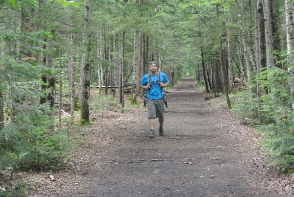
The trail starts by crossing the East Branch of the Pemigewasset River on a suspension bridge and then follows the river’s west bank along a former railroad bed. The trail is wide and flat and in places old railway ties stick up above the gravel surfacing.

We turned up the Osseo trail and, as it turned out, chose a pretty good spot to refill water before the climb. The climb was initially quite easy underfoot, and we kept waiting for the footing to grow steeper and/or more challenging. We were pleasantly surprised to see a significant amount of infrastructure channeling water off the trail in wet spots and providing steps and even a ladder in steep places.

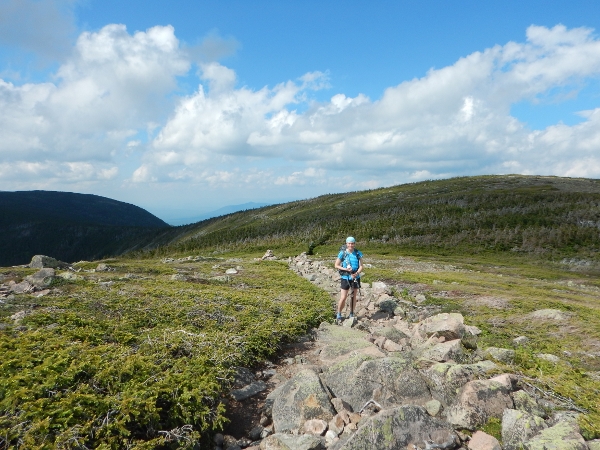
It was a grey morning with low clouds, so we figured that we were probably missing some good views on the way up. We stopped at the first official viewpoint, or “downlook” just as the day was beginning to briefly clear. We took a short break for a snack and prepared ourselves for the remainder of the climb, taking time to stop wherever there were views along the way.
Much sooner than we were expecting we had reached the top of the climb and passed the junction with the Flume Slide Trail. By this time the fog had returned and was growing thicker. A few moments later and we reached Mt Flume. Well, we assumed it was Mt Flume. We were expecting to find an official sign or marker, but it seemed clear despite the fog that we were at the highest point around.

We snapped a few photos of the fog and decided to break for lunch. We were soon joined by a couple arriving from the other direction. They were out for a day hike to do some “peakbagging”. We had a nice chat and then they headed back in the direction they had come. As we were finishing eating, someone came running right up behind us. He was the first of a group of 4 hikers who were doing a dayhike up the Flume Slide Trail and over to the Liberty Spring Trail.
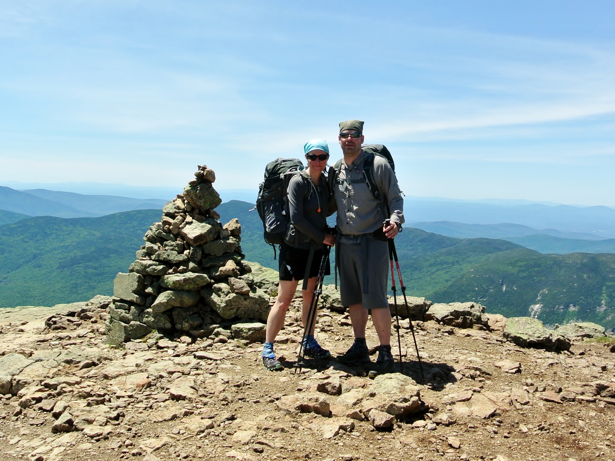
We packed up from lunch and moved quickly on to Mt Liberty. By the time we reached the open summit the thick fog was transitioning to heavy rain. It was windy and cold. We took a few quick shots then layered up and were happy to duck back into the treeline.

It was just a short hike from here to the junction of the Liberty Spring Trail (part of the Appalachian Trail) which marked our detour down to the Liberty Spring campsite. We were pleasantly surprised to be arriving into camp just after 2pm! We discussed the fact that we could have probably easily made it to Garfield Ridge campsite in one day (with an earlier start), though we weren’t going to change our plans at that point. We were holding tight to the promise of sunny weather to accompany us across the Franconia Notch the next day.
We were curious to see our first AMC backcountry campsite. We knew they each had a water source, composting outhouse, bear boxes, caretakers, and some tent pads, but we hadn’t seen photos of them and weren’t sure how ‘first come – first served’ actually worked in the backcountry. We didn’t expect too much traffic mid-week in June, except that we were now on the AT in the busy season. We needn’t have worried – I think we were the only ones there that night. The caretaker had us follow him down to his canvas tent for “registration”, which consisted of him recording our first names and taking payment for the night. We were totally taken aback when he asked, “Cash or credit?” We were sure that we’d read that everything was cash only. Apparently they also record credit card information and process payments manually offsite. Makes sense, but we were not expecting it.
He told us to take site #4, and we headed off to set up the tent in light rain. You reach site #4 by walking right through site #3, but that was fine since we were the only ones there. The campsite itself has a neat layout, with the tent sites and outhouse strung out on one side of the main trail with the water source and food/cooking area on the other side. There were bear warning signs everywhere, which the caretaker told us were the result of a “regular visitor” over the last 2 summers, though it hadn’t been seen yet this season.

We set up quickly just as the rain was growing heavier, thankful that our tent pitches with the fly first. Wade had pre-attached long guy lines to the tent, and setup was almost instantaneous as the lines easily slipped around attachments on the sides of the tent pad. So far, so good…
We headed back over to the food area. We would have been happy to chat with fellow hikers but we didn’t see another person for the rest of the day, well, other than walking past the group of 4 from Mt Flume who stopped to use the outhouse on their way down to their car. We sat under the tarp that covered a cooking area, chatted about the day and just passed the time until we were ready to cook supper. An afternoon nap sounded nice, but would probably just have set us up for a restless night. We did have ample time to admire the AMC’s setup, including signage advising to keep the watershed area clean, big red job boxes serving as bear-proof food storage, the cooking shelter, and the dish-washing station… it was exceptional.

By the time we cleaned up from supper the rain had passed as predicted. Fingers crossed for a sunny morning!
Day 2: Liberty Spring Campsite to Garfield Ridge Campsite
11.8km, 8:22 (moving 4:16), Gain 1119m, Loss 1607m
As promised, the weather had cleared by morning so we had a quick breakfast and set out back up the Liberty Spring Trail. We’d be on the Appalachian Trail all day, and were curious to see how many through hikers vs day hikers we’d see along the way. The trail was uphill for the first 15-20 minutes, then levelled out for the walk over to Little Haystack. By the time we reached this point we knew it was going to be a busy day. It seemed to be mostly day hikers enjoying the good weather. We definitely enjoyed the first few above-treeline views!

We took a break on Little Haystack to admire the views, and then headed on to Mt Lincoln. It was crowded, though we managed to get some clear photos.
A quick photo-op then we found a relatively quiet spot for lunch.

As planned, this was a slow day with lots of stops to admire the views and take photos as we made our way to Mt Lafayette.

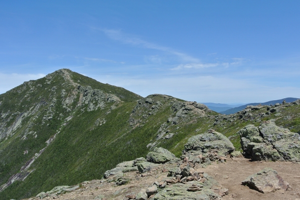
After Lafayette we knew we were nearing the end of the ridge, though the views were no less spectacular.


It is pretty easy going up on top, until you pass the junction of the Skookumchuck trail and drop below the treeline. The trail becomes far more rugged beyond that point, with steep areas and sections requiring scrambling.

Next stop was Mt Garfield, which is pretty imposing from this direction, as you can see the valley and impressive descent that separates it from Lincoln from a very long way back. Once you arrive, the viewpoint just below Mt Garfield provides a great look back to the Franconia Ridge.

From there it’s just steps to the summit and the base of an old fire tower.

We were getting hungry by this point so kept moving on to the Garfield Ridge campsite, which is located just off the Garfield Ridge trail. We hadn’t fully appreciated the 0.2mi side trail was a steep climb, or we would have grabbed water on the way in. In retrospect, the walk back down for water was probably a great cooldown. We had a fairly private site, but there were a lot of other groups of campers – including a bunch of AT throughikers in the shelter.

Day 3: Garfield Ridge Campsite to Guyot Campsite
13.3km, 9:43 (moving 4:48), Gain 1060m, Loss 1018m
We were trying to time this day to have lunch at Galehead Hut, but we weren’t sure exactly how long it would take to get there. We were definitely not expecting the steep rocky descent through a water course right below the campsite.

After about an hour the trail leveled off and our time picked up. As it turned out, the morning worked out perfectly and we arrived at Galehead in time to share a piece of (amazing!) carrot cake before climbing up to the summit. The summit itself is viewless, though there is a viewpoint near the top that looks out over the hut and off to South Twin and beyond.

The round trip was about 40 minutes and once back down we gave ourselves the better part of an hour to eat lunch and relax before heading out again. Galehead is one of the recently renovated huts which has been made fully wheelchair accessible (and yes, it has been accessed by wheelchair). On this day there were more staff than visitors, and we were served a spectacular black bean soup which we capped off with more carrot cake before grabbing Snickers bars to enjoy at the top of South Twin (we were well aware of the steep climb that lay just ahead).

Though the climb to South Twin was steep, we both agreed it was better to go up than down.

We passed two women coming down who told us they were dropping off their packs at Galehead Hut before climbing back up to go over to North Twin. No thanks from our point of view (though I hope they had a great day!).
The views from South Twin were once again spectacular.


We were feeling pretty lucky with the weather conditions on this trip. Though dark clouds were on the horizon and closing fast, we’d had great weather on the Franconia Notch and were mostly finished above-treeline travel, so we would have accepted anything from this point on. From the map and trail description we thought we would make good time along this stretch, and we were right.

We didn’t see anyone until we approached Mt Guyot where there was a small crowd of people ahead wearing huge packs. They moved off toward the Guyot campsite before we arrived. We were worried this might mean the campsite would be crowded, but there was plenty of room.

We learned that the group were trainees finishing an AMC leadership program to become certified to lead youth.

After quickly setting up camp we headed back out to hike up to the summit of West Bond. We generally plan for an early morning departure on the last day of a trip so that we can enjoy the evening once we are out and cleaned up, so it made sense to get this one out of the way the night before. Plus, we knew it might be raining in the morning. Rain was threatening as we headed out, and we kept changing in and out of raingear along the way. It wasn’t until a few feet from the summit, however, that the fog closed in…

No real views tonight, though we still grabbed the obligatory “selfie” which meant that we could tick another 4000′ off the list.

Back in camp, we joined the AMC group in the cooking shelter and heard about some of their adventures. All in all it was an entertaining evening, though we went to sleep early planning on a 6am departure.
Day 4: Guyot Campsite to Lincoln Woods Visitor Center
17.1km, 6:13 (moving 4:53), Gain 698m, Loss 1606m
We got up to light rain and an otherwise quiet campsite at 5am. Unfortunately we had already been rudely awakened by water hitting our faces at 2am. Outside was a hard rain but it was nowhere near extreme without any wind and the water was still bouncing off the platform underneath the fly directly into the tent through the mesh sidewalls. It wasn’t just a few drops – it was enough that we packed up one down sleeping bag to keep it dry. We spent the next hour or so continually wiping the mesh with pack towels until the rain finally let up. It was a restless night.
Once we were up the rain got heavier and we were thankful for the cooking shelter which made breakfast and the final packing much more enjoyable. We headed out in a major downpour about 6:45am, knowing that we would probably warm up pretty fast with the steep climb up out of the campsite. We were glad to have West Bond out of the way – we weren’t looking for any detours at this point.

Luckily the heavy rain didn’t last long, though summiting Mt Bond was rather unremarkable in the heavy mist.

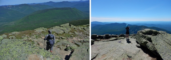
But as we neared Bondcliff the weather gave us quite the show. Fog was billowing across the trail, with huge vistas briefly opening up and then disappearing behind heavy fog and bursts of rain. The gusts were enough to keep you on your toes.

Those 4 pictures were all taken within 5 minutes of each other. They don’t remotely capture the experience but they’ll have to do until/unless we start to use video in our blogs.


We’re not even 100% sure our Bondcliff “selfie” is even at the true summit, but we were definitely in the right area. I can’t wait to come back and see the views on a clear day. Right after Bondcliff we re-entered the treeline and started the long descent back towards Lincoln Woods.

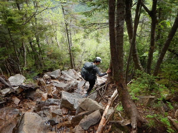
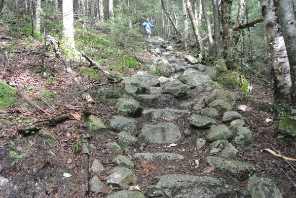
We passed only a few hikers on their way up. The descent was gradual and not too hard under foot, with this one particularly impressive set of stone steps at a steep spot.
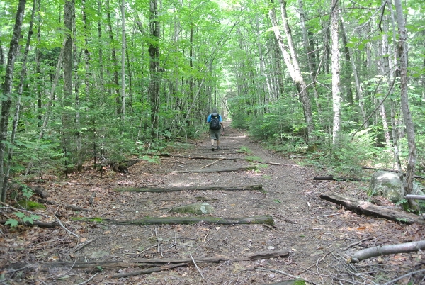
The woods portion of the trail is lovely, followed by a long converted rail trail back to the car. That part seemed to go on forever.
We saw a lot of hikers heading in (it was a Friday). Definitely a wide variety of pack shapes and sizes. We also passed one of our favourite educational displays… a physical demonstration of how far 200 feet actually is, with signposts at both ends so that hikers can count their paces. For anyone who doesn’t know why 200 feet is significant, the full text of the sign is in the photo caption below.

And just when you think it’s never going to happen (we really don’t like walking on flat straight trails) we were back to the suspension bridge and just a few hundred feet from the car!

GPX Track

High / Low
The high was finally getting into the White Mountains and seeing that we were in good shape for the trails. We’re set to tackle the rest of the 4000 Footers now, as soon as time allows. The low was definitely getting wet in the tent. We bought the Scarp 2 specifically for extended trips and rotten weather… but it has turned out to be a bust. There have been a number of issues, but raining inside the tent at Guyot was the final straw. It seemed like such a great tent design for a lot of reasons, but for us these issues will limit its usefulness to winter trips.

The whites are some of our favorite hiking adventures and you covered some of the best mountains in the range. Thanks for sharing. A great account of an awesome experience.
LikeLike
Thanks for taking the time to write. This really was an epic introduction to the Whites. We were lucky enough to get back again this summer to see a few more great peaks.
LikeLike
Hello,
I would like to use your photo of the Guyot campsite with the caretakers tent and signing for a public. May I have your permission to use that photo and if so, who do I credit the photo to?
Thank you for the consideration.
J. Dan Abbe
White Mtn. National Forest
LikeLike
Hello. Glad to see that you found our blog, and that some of our photos might be useful. Please send us an email at misadventuresinthewild@gmail.com.
LikeLike
Thank you so much for sharing your adventure!! We’ve done the 48’s including a couple of overnights but have our sights set on a four day Pemi loop this summer and info as detailed as yours for the same trip duration has been scarce. It’s been great validation of my expectations and very helpful. Sorry about the tent but glad it was a successful trip!
LikeLike
Thank you Krista. Congrats on 48! We started this blog for exactly that reason – sometimes it’s hard to find information when we are planning trips. (In case you didn’t see our other post, we returned to the same area last summer — Pemi Semi Trip Report July 2016). And if you ever have any specific questions, feel free to email us at misadventuresinthewild@gmail.com. All the best!
LikeLike